ICAO Locator: KTYS
Coordinates: 35.81111, -83.99389
Location: Knoxville, Tennessee, U.S.A.
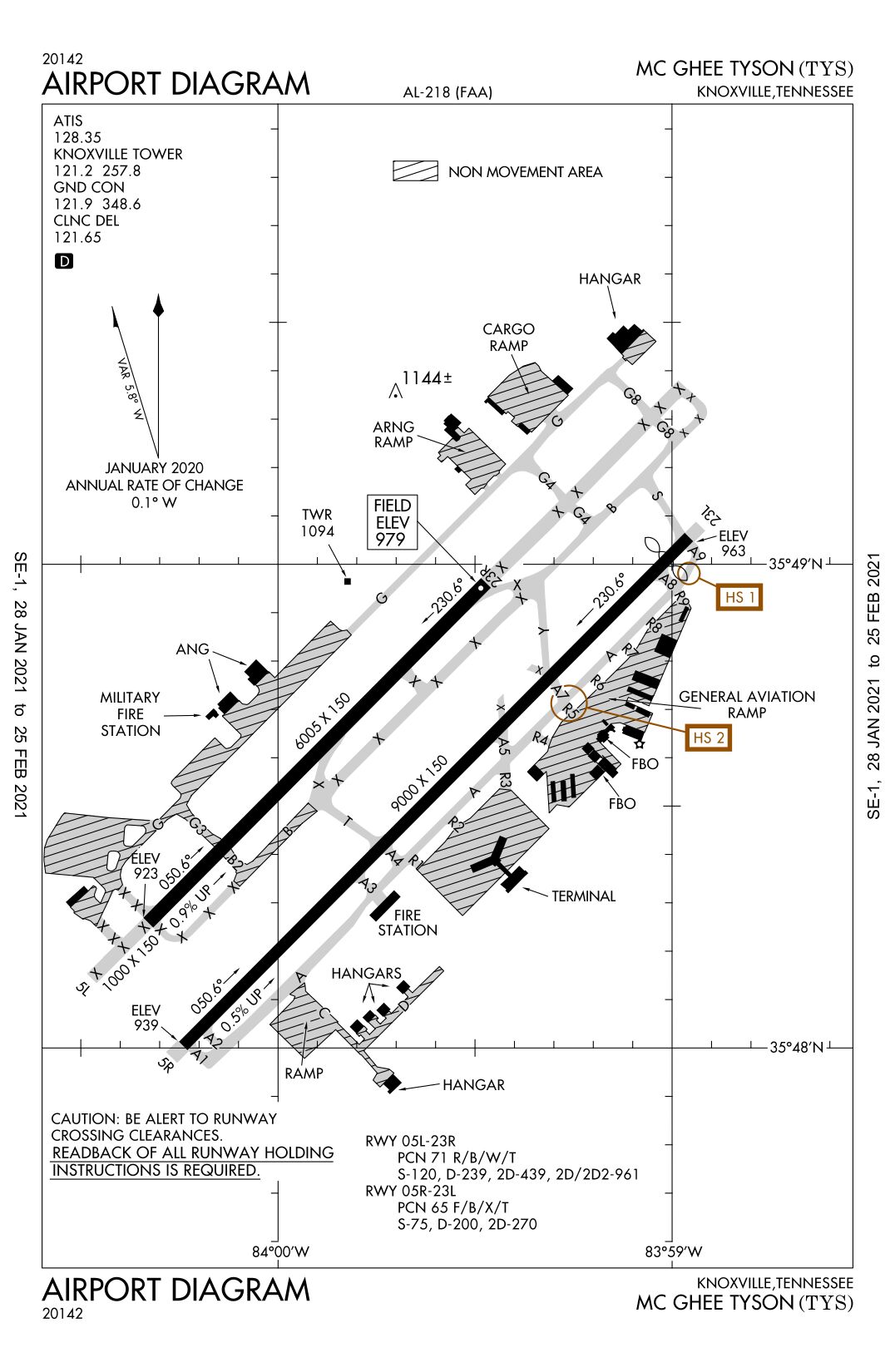
| Airfield Diagram | - diagram of airfield. |
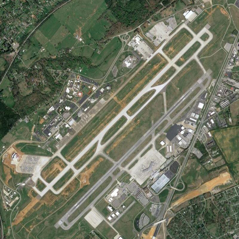
| Satellite View | - the whole airfield. |
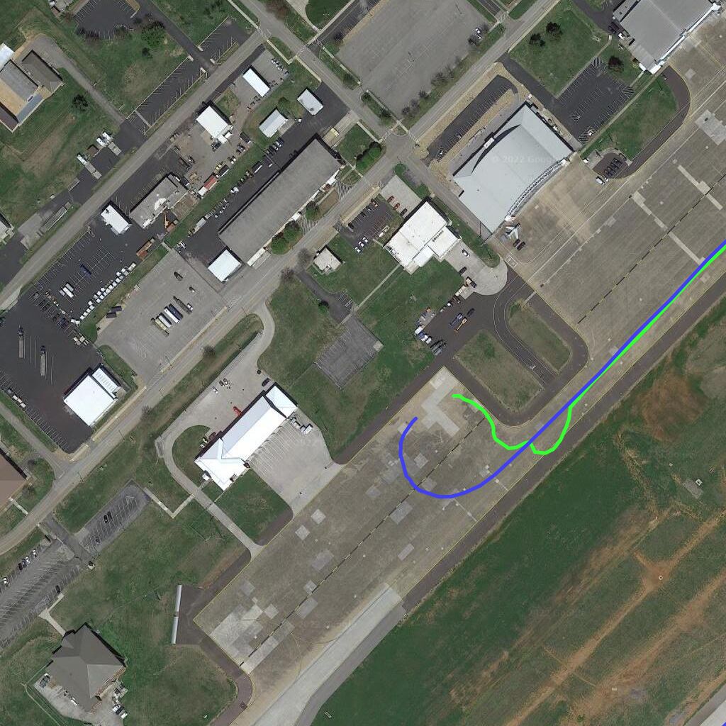
| Military Apron | - special flights made by RAF C-17s perform loading operations on an apron in the military area of the airport. This is at the westernmost part of the airport, northwest of the shorter runway (5L/23R). The apron is immeditely south of the military fire station. The coloured lines on this image show the path of C-17 ZZ174 on 15th (green, arrival) and 17th (blue, departure) of November, 2022. |
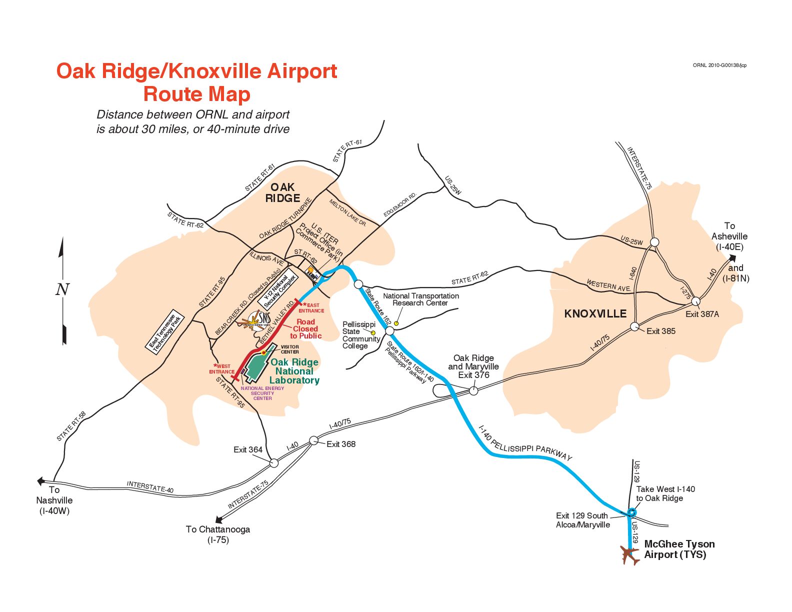
| Connections | - the airfield is used for connections to the Dept of Energy's Oak Ridge National Laboratory. |
Satellite photos from Google Maps