ICAO Locator: EGVN
Coordinates: 51.75000, -1.58333
Location: Witney, Oxfordshire, U.K.
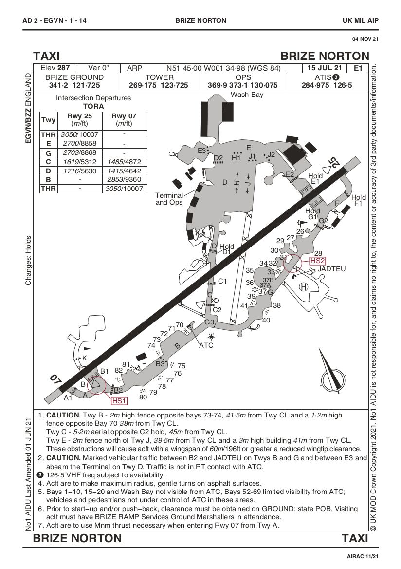
| Airfield Diagram | - diagram of airfield, extract from AD 2 - EGVN. This is info for aircraft operating on the airfield, labels reflect this. |
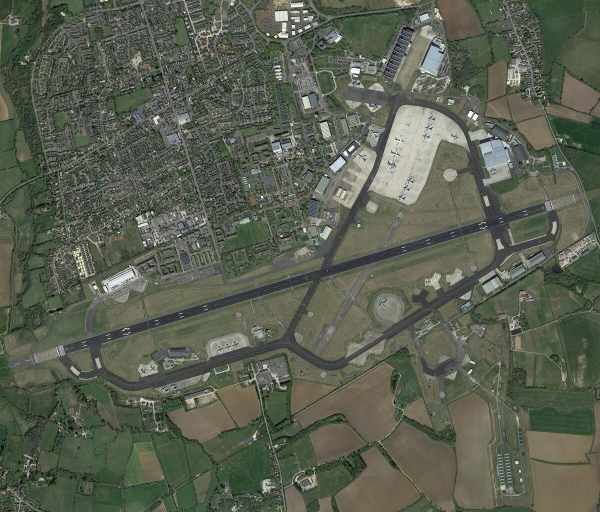
| Satellite View | - the whole airfield. |
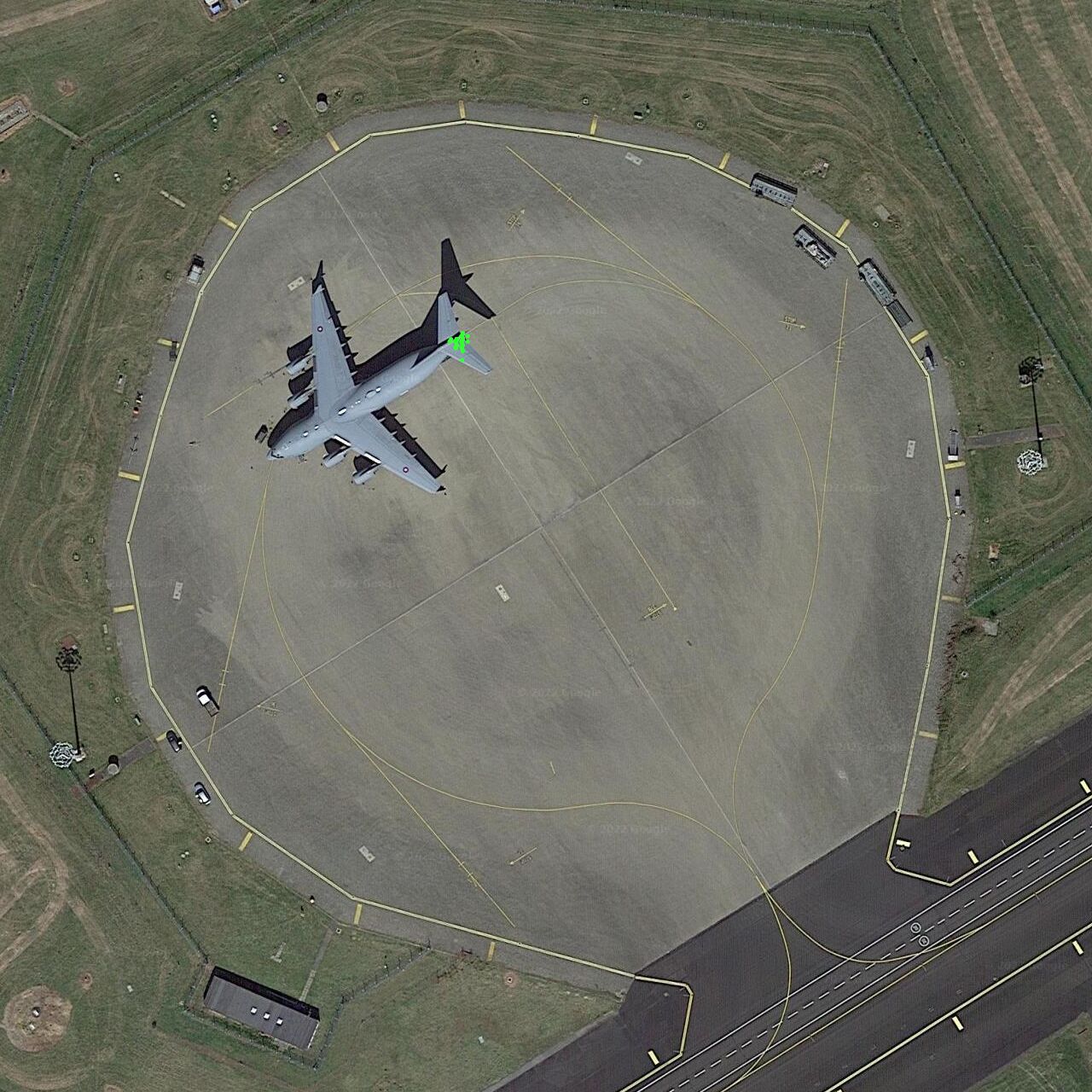
| Bay 36 | - the aircraft loading pad for hazardous / high value cargo is to the north side of Taxiway G (south of the runway in the eastern part of the airfield). Fortuitously, GoogleSat captured a C-17 on the pad. It's nose points towards the pad perimeter at position '36' marked on the diagram above, and thus the name 'bay 36' has been used for this position throughout these documents. The green dots overlaid on the photo indicate ADS-B position reports of RAF C-17s on the ground before/after special flights. |
Satellite photos from Google Maps