ICAO Locator: EGUL
Coordinates: 52.408333,0.556667
Location: Lakenheath, Suffolk, U.K.
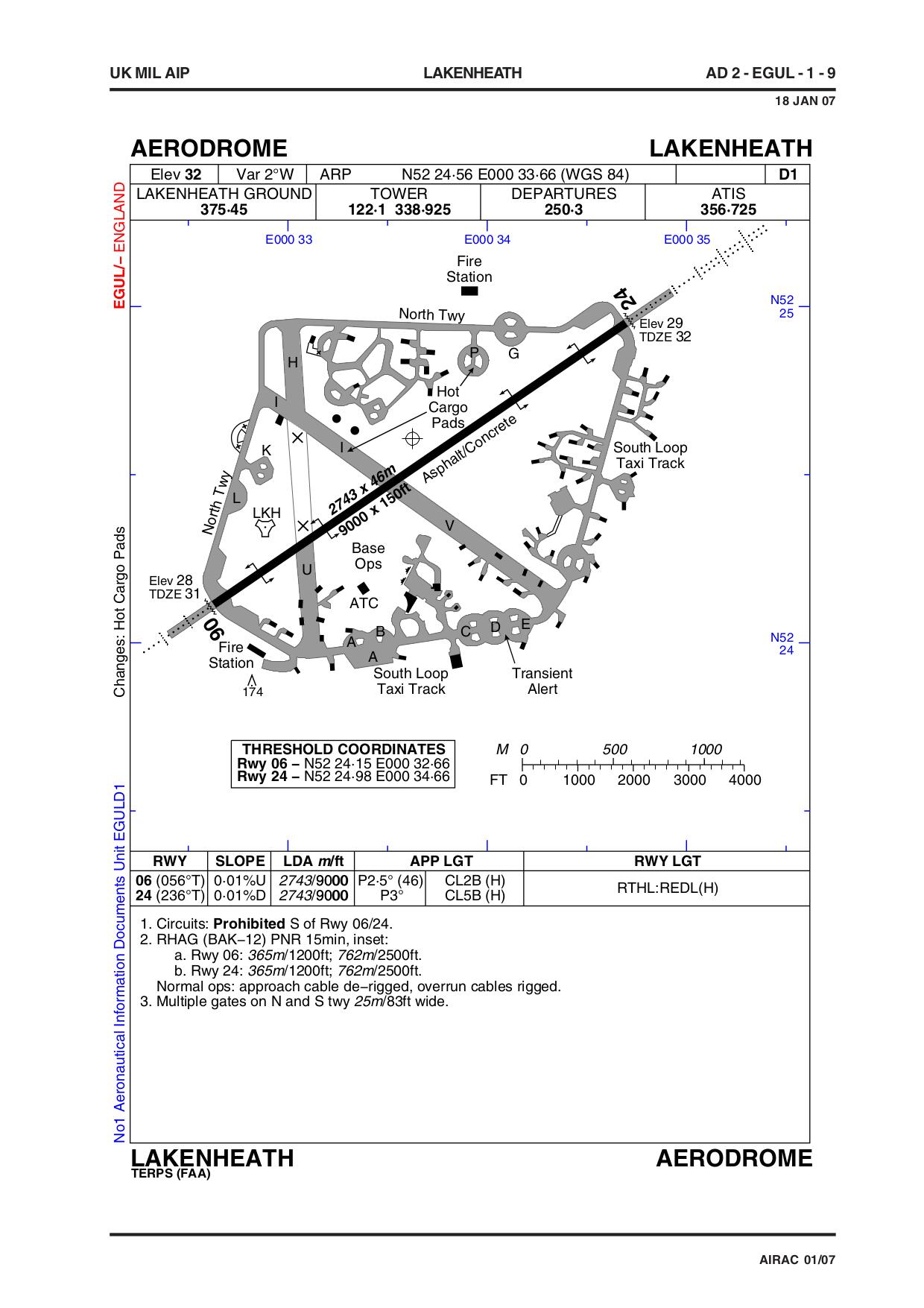
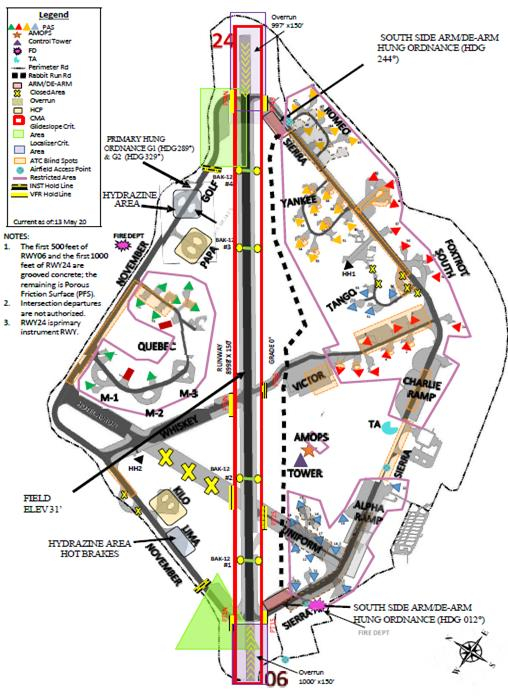
| Airfield Diagram | - diagram of airfield.
Two ‘hot cargo pads’ are indicated, P near the North Taxiway, and along Taxiway I. See ‘Hot Cargo Pads’ below This page of the source document is dated 2007; the current (Jan 2023) version on MoD website is text only!?!? |
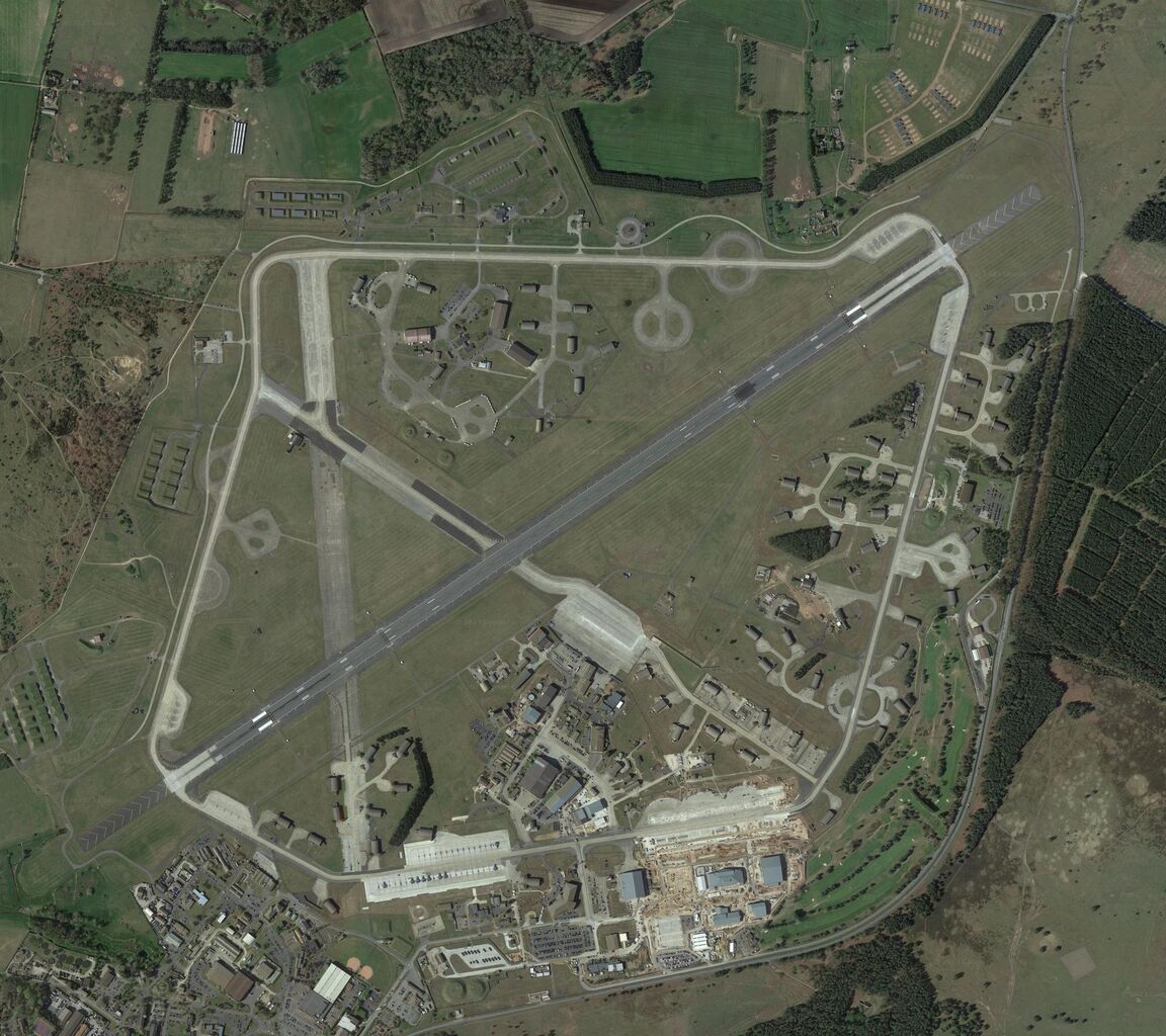
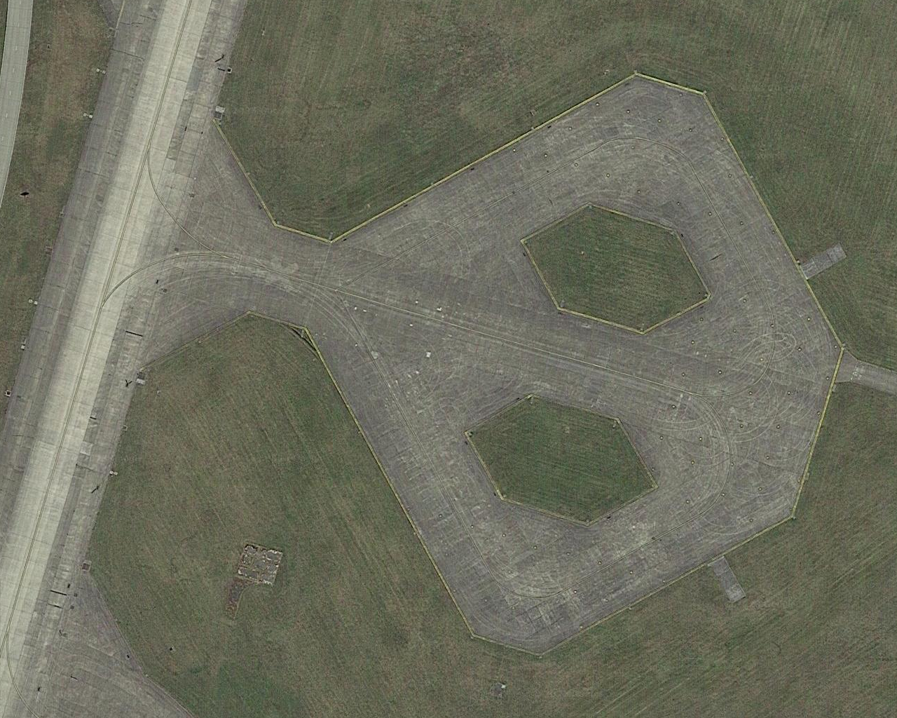
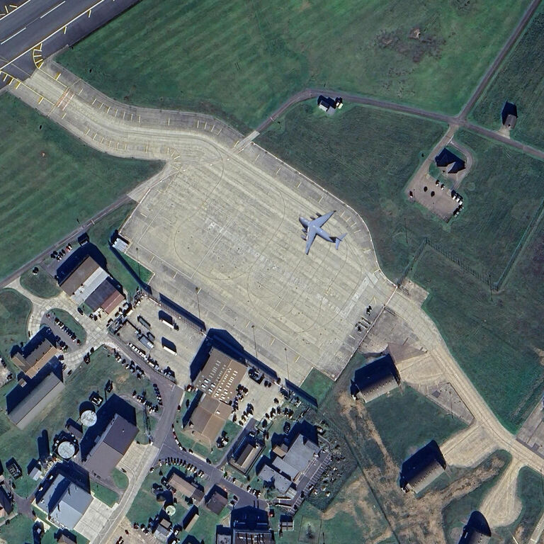
| Satellite View | - satellite view of whole airfield.
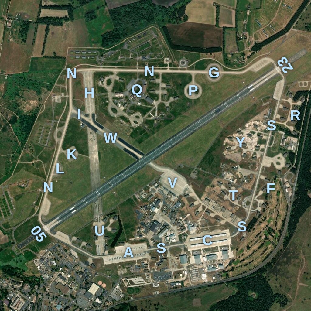
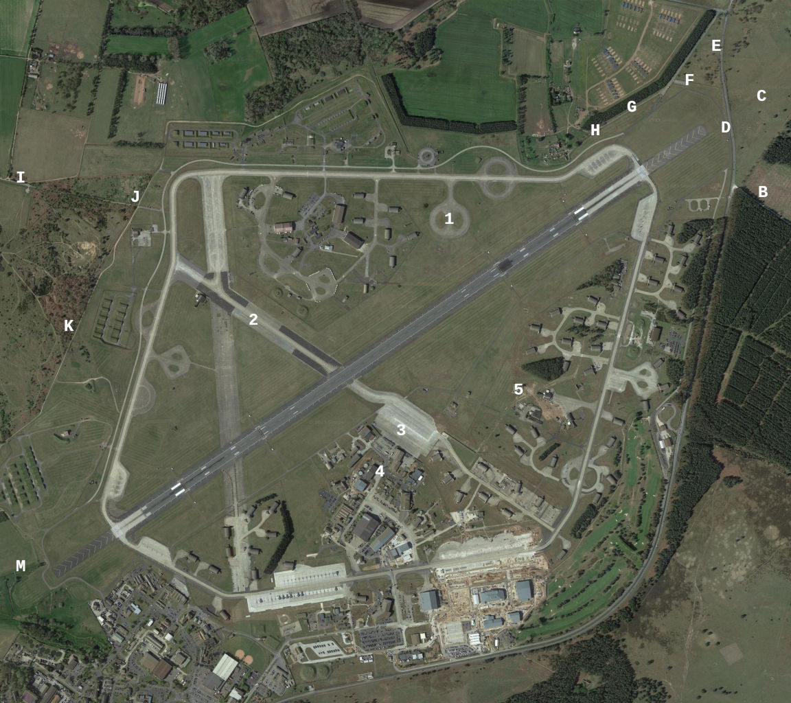
It can be seen that taxiway I has new asphalt margins in parts, and surface markings indicating that aircraft should stay on the central concrete strip. A handy-sized newer version, annotated with names according to official documents, is here. (source: ArcGis map tiles) A larger, higher quality version (2304x2048 pixels, 3.9MB) is here. Another version is here, annotated with letters as per Thunder and Lightnings guide, and the following numbers indicating notable features on the airfield:
|
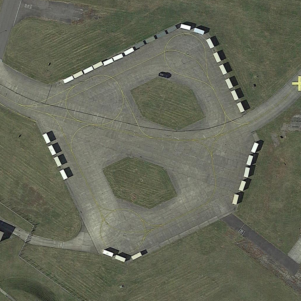
| Hot Cargo Pads | - pad K and
pad P (‘1’ on the annotated satellite view)
are currently designated hot cargo pads, according to
this diagram on p104 of
this document.
During Cat 0 missions, the spare C-17 for Europe has been observed parked on pad P, as this satellite view from 2023-06-10 shows (photo from Arcgis Online). There is a pad similar to K on the northern shelter loop, pad M-3. |
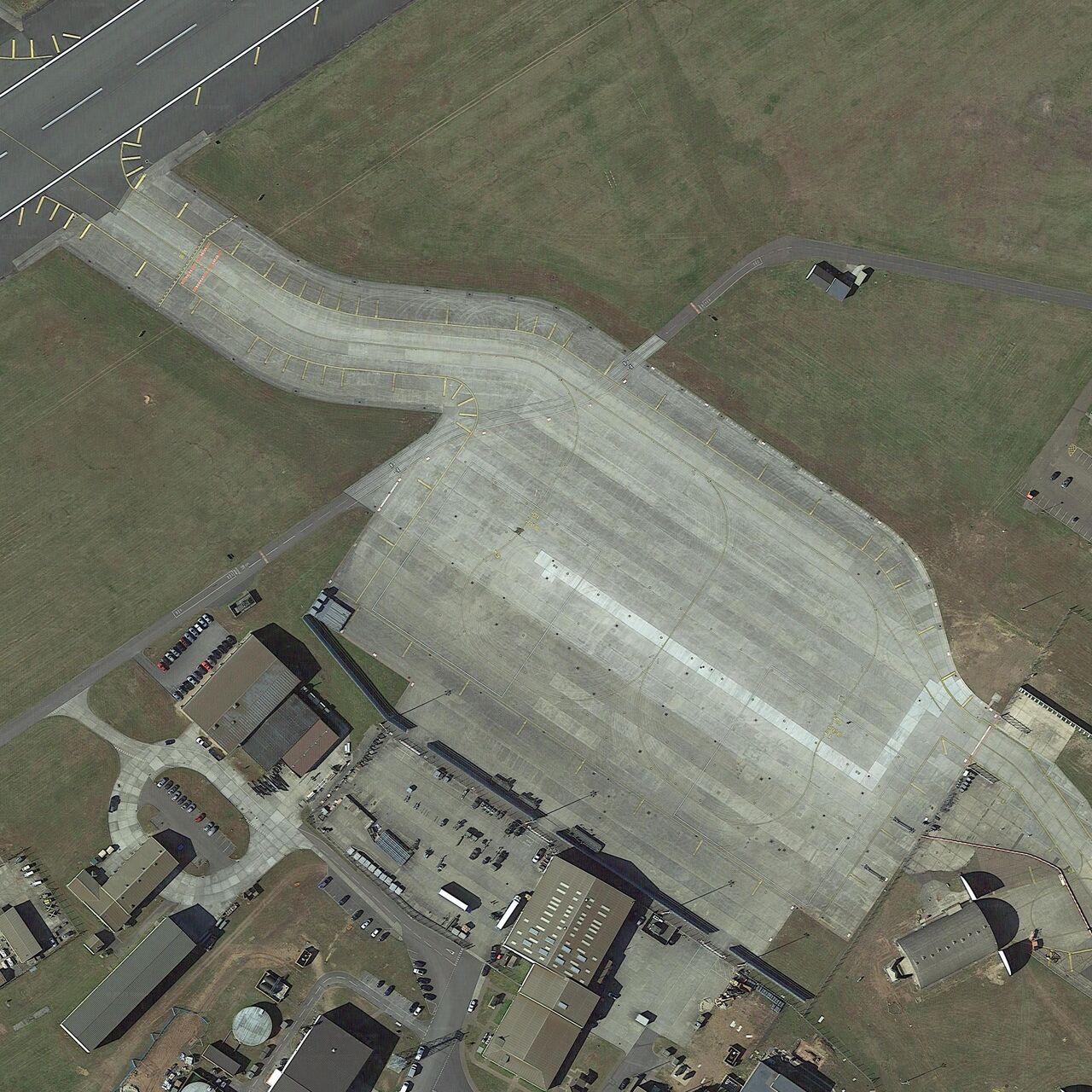
| Victor Ramp | - satellite view of Victor ramp, an apron for large transport aircraft,
adjoning taxiway Victor.This is marked out for three aircraft types (C-17A, B747-400, C-5A) and
can handle two aircraft at the same time. A maximum resolution version (2560x2560
pixels, 5.4MB) is here
This area and taxiway Victor are stated to be closed in the MoD text document mentioned above (dated 2020-10-08). However, it was in use throughout 2024. In 2025, training began on Victor ramp with PNAF. This mock-up shows the position and orientation of the C-17. Note that it is close to the gate onto Victor taxiway east, which leads into the vault storage area, and not on either of the designated cargo aircraft positions. |
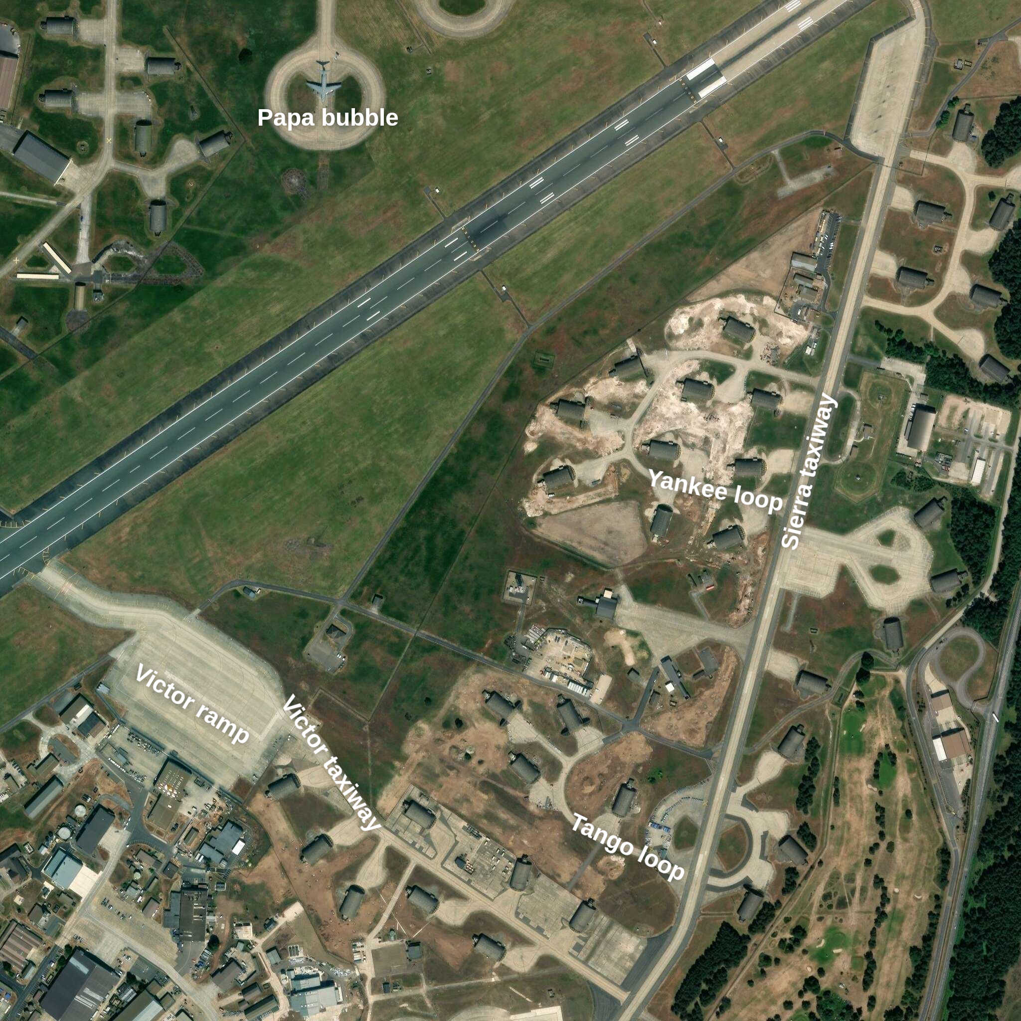
| Vault Storage Area | - satellite view of the area around the 22 protective aircraft shelters, which have been refurbished in the 2020s. View includes Tango and Yankee loops, Victor ramp, and Papa bubble. (source: ArcGis map tiles) |
| See also the page Lakenheath Renovation. |
Satellite photos from Google Maps, except where stated