The story begins with a NOTAM issued Feb 28th 2025:
A) EGVN B) 2503060900 C) 2503061600
E) TWY G CLSD BETWEEN EAST OF BAY 28 TO JADTEU POST
This is the area of interest: (source Google Maps)
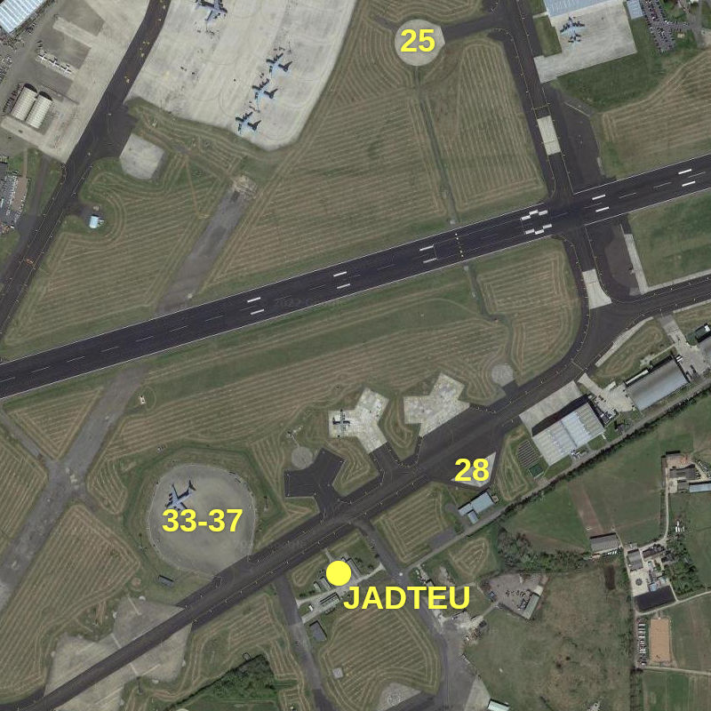
Taxiway G is the taxiway that runs east-west south of the eastern part of the runway.
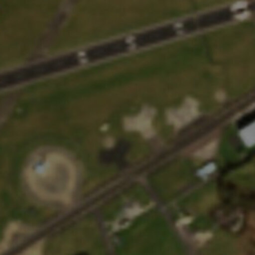
On March 4th, C-17 ZZ175 was prepared for departure on bay 25 and left at 12:33. It flew to Knoxville. On the image below, you'll see the C-17 on bay 25, but notice there is also a C-17 on the usual hazardous cargo pad, labelled 33-37 on the first image.
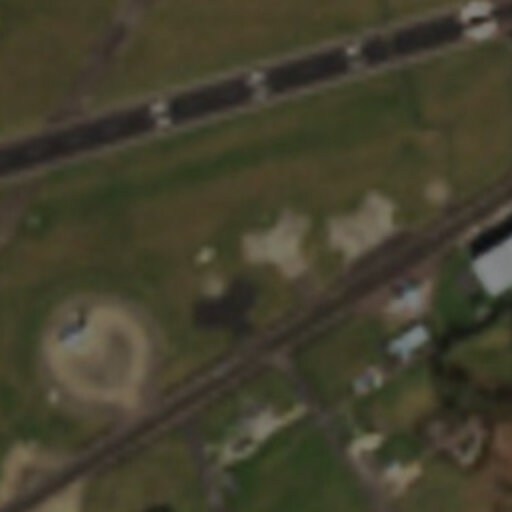
C-17 ZZ175 left Knoxville at 02:44 on 6th March and landed at Brize Norton at 10:35. The early landing time means it would most likely appear on a Sentinel2 photo taken that day:
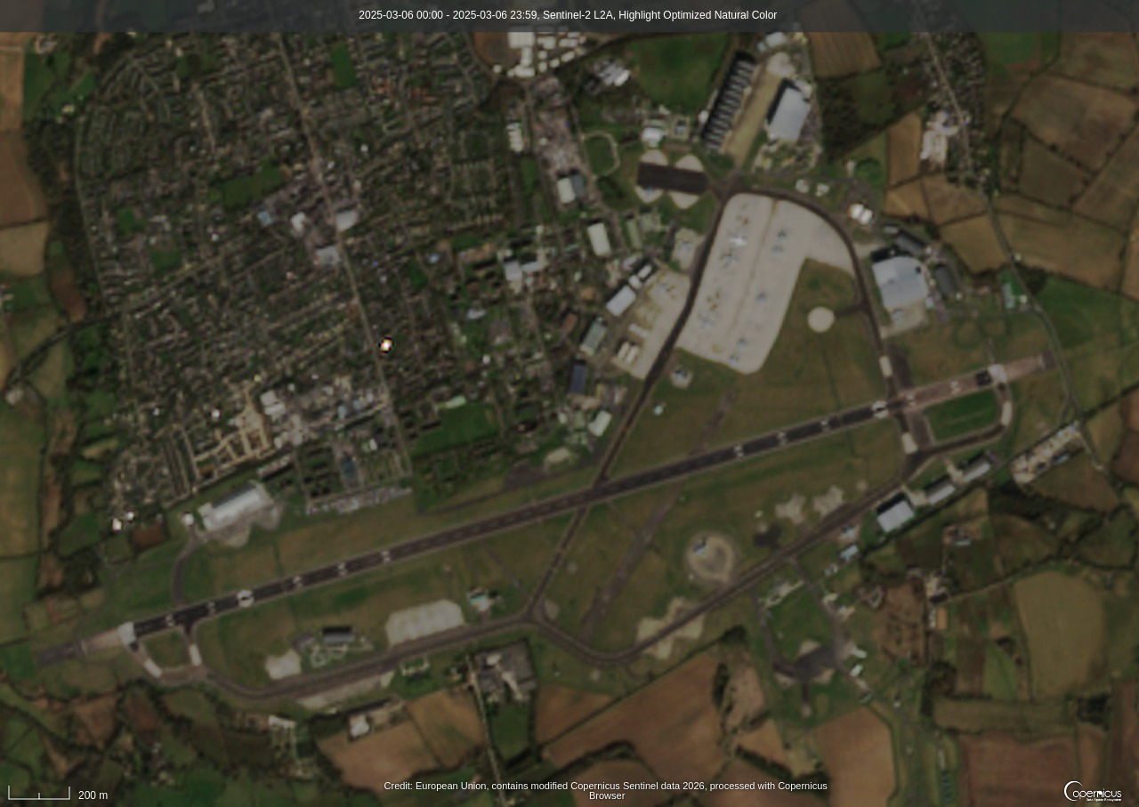
You'll notice a C-17 on the hazardous cargo pad as on the 4th. Bay 25 is empty. But there is also an aircraft of similar size on bay 28. I have no way to know exactly which aircraft these were. Here are enlarged cutouts of the relevant area for both days:
|
|
Since the 6th March photo was taken during its period of validity, it seems most likely that the NOTAM refers to the aircraft on bay 28 and whatever was happening around it. Since the NOTAM was posted 6 days earlier, this was a planned activity.
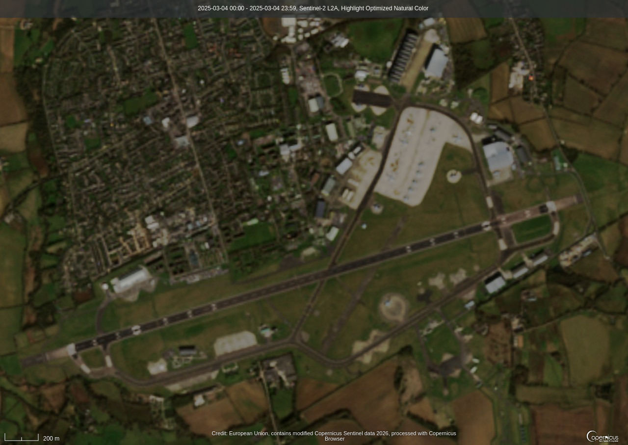
Here is a close-up high resolution image of bay 28 and the complex of buildings between it and the perimeter road: (source ArcGis map tiles)
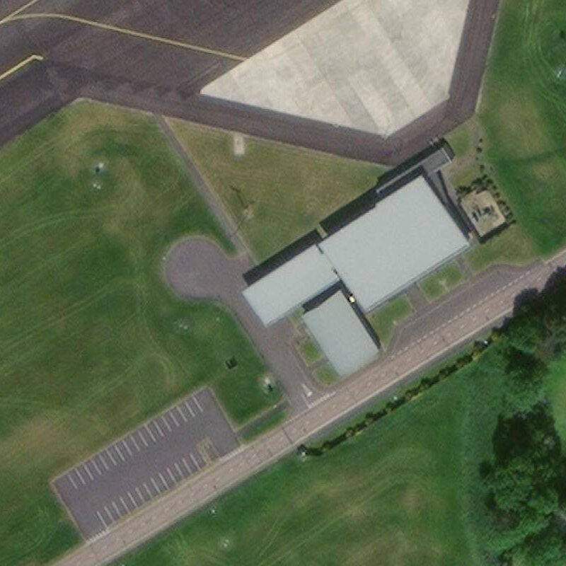
A few points to note. These buildings form a bridge between airside and landside. There seems to be vehicular access to the buildings on the western side. Note also the empty car park next to it.
You can view several other satellite photos of this facility taken over the years here.
The darker grey part of the building right next to the aircraft parking area is movable, sliding along the north-west side of the largest building. In different photos it appears in different positions. This most likely is a door, or a screen over a door, allowing movement of personnel or cargo between the building and the loading pad, but, judging by its thickness, it was designed for security or safety.
The linked archived satellite photos show the facility was already in place in 2011, while the hangars immediately to its east, which also bridge airside-landside, were constructed between 2011 and 2014.
Look back at the image for bay 28 on 6th March. You'll notice what appear to be large vehicles on the road next to the car park, or maybe on the car park. If you've looked at the archived satellite photos linked above, you'll know that the car park is usually empty.
Joining all these dots, my theory is that on 6th March, ZZ175 landed and taxied to bay 28, where it was unloaded. The cargo was then transferred through those buildings to the vehicles waiting on/by the car park. These buildings may also form a secure storage facility.
Usually loading/unloading takes place on the haz cargo pad, presumably with the load-carrying vehicle present. In March 2025, this pad was not used, for reasons unknown. One possibility is that the C-17 there had a problem that meant it could not be removed from the pad until fixed. However bay 36 was in normal use between the posting of the NOTAM and the mission to Knoxville. (When the NOTAM was posted, ZZ175 was at Kirtland AFB preparing to return via Westover ARB.) Thus it seems more likely that the use of this facility was due to the nature of the cargo, meaning it was different to what is usually transported by these flights.
Flight data mainly from ADS-B Exchange, additional material from AIRPLANES.LIVE, and Flightradar24